Isaias ends historic Atlantic hurricane lull after sunny southern summer

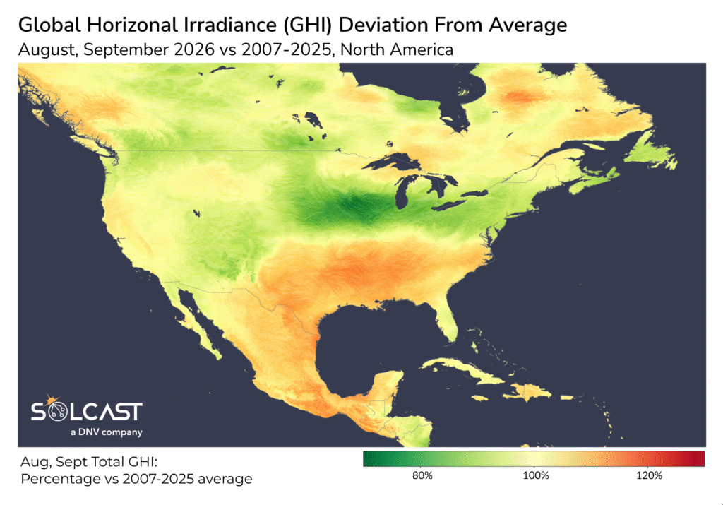
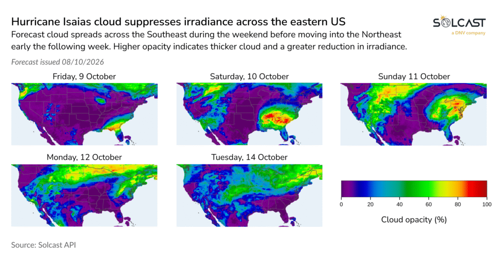
An historically quiet Atlantic hurricane season and persistent high pressure brought sunnier-than-average conditions to Mexico and the southern United States during August and September, according to analysis using the Solcast API. Irradiance was around 10% to 20% above average across the southern states, with similar increases across much of Mexico. The prolonged dry weather also created conditions for soiling losses to build across the region. That pattern is now changing as Tropical Storm Isaias strengthens over the Gulf of Mexico, bringing widespread cloud and lower irradiance to the eastern United States.
The lack of hurricane activity was historically rare. Only two seasons since the late 19th century, 1907 and 1914, have passed without a recorded Atlantic hurricane, although both occurred before satellites made storm detection more reliable. The latest first hurricane on record formed on 8 October 1905. Reaching early October without a hurricane therefore placed 2026 close to that record and made the season particularly unusual in the satellite era.
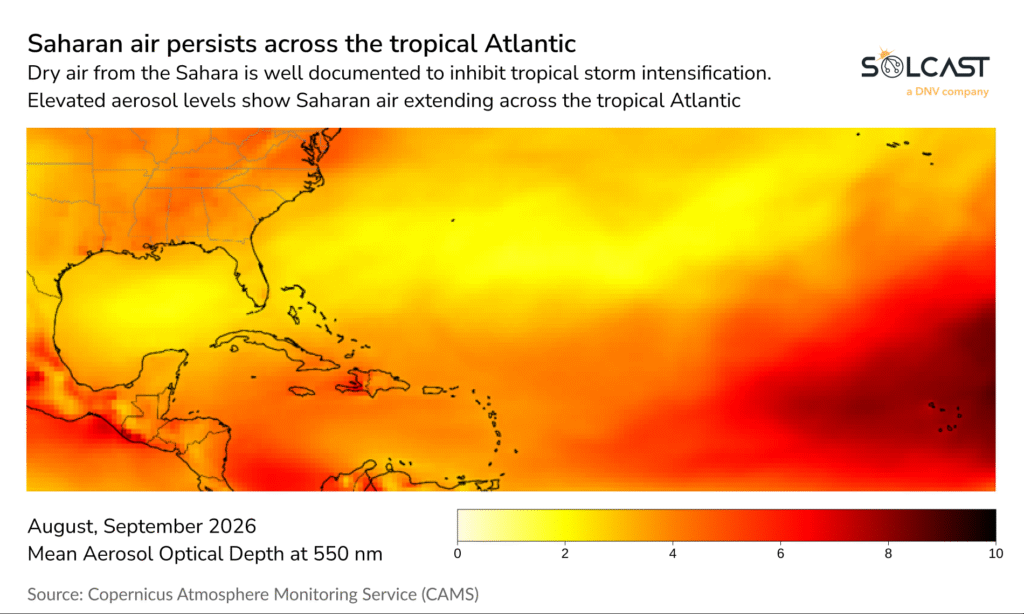
Eight tropical storms had formed by early October, but none had strengthened into a hurricane. El Niño produced stronger wind shear across the tropical Atlantic, disrupting storm development. Saharan air may have provided a further constraint on intensification.
The quiet Atlantic season coincided with persistent high pressure over the south-central United States, limiting cloud formation. Irradiance was around 10% to 20% above average across the southern states and much of Mexico during August and September. Baja California was the main exception, reflecting greater tropical cyclone activity in the Pacific. Conditions were cloudier farther north, particularly across parts of Iowa, Illinois and Indiana.
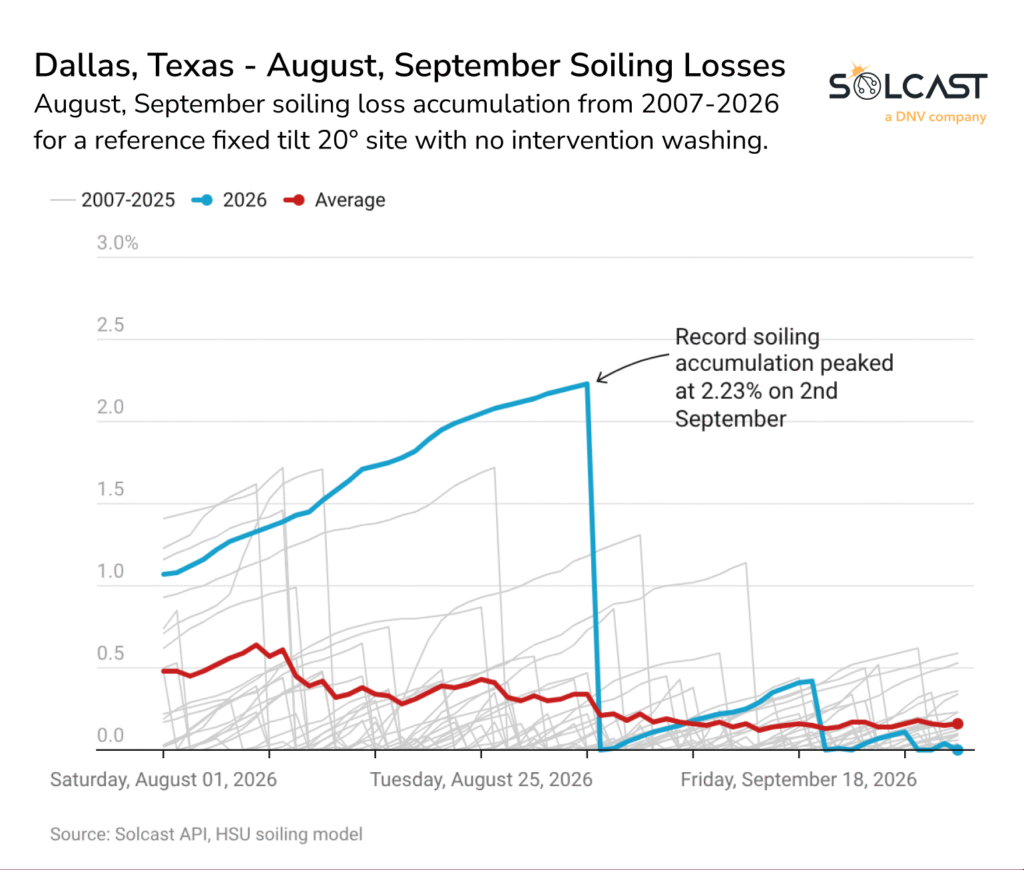
The prolonged dry weather would also have allowed soiling losses to build across the region. Continuing the Dallas case study from last month’s analysis, average modelled losses across August and September reached 1.08%, compared with the 2007 to 2025 average of 0.28%, the highest result in the 20-year dataset. Losses peaked at 2.23% before rainfall mostly cleared soiling accumulation.
The unusually quiet period is now expected to end with Isaias. At the time of writing, the system had formed in the Bay of Campeche and was forecast to become the season’s first hurricane before reaching the central US Gulf Coast. Forecasts indicated that Isaias could strengthen to Category 2 before making landfall on Saturday, with a storm surge watch extending from the mouth of the Mississippi River to Yankeetown, Florida.
Solcast produces these figures by tracking clouds and aerosols at 1-2km resolution globally, using satellite data and proprietary AI/ML algorithms. This data is used to drive irradiance models, enabling Solcast to calculate irradiance at high resolution, with typical bias of less than 2%, and also cloud-tracking forecasts. This data is used by more than 350 companies managing over 350 GW of solar assets globally.
The post appeared first on pv magazine Global.

 点赞
点赞 收藏
收藏 点踩
点踩 分享
分享