Chicago forecast: ‘Unsettled' weather pattern moves in with risk of strong to severe storms

An unsettled weather pattern with strong to severe storm chances is in the Chicago forecast this week.
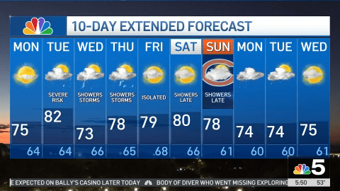
The rain chances start Tuesday and last through at least Thursday, NBC 5 Storm Team Meteorologist Iisha Scott said. Monday, Scott said, will be sunny and clear, with a chilly morning followed by high temperatures in the mid 70s.
Monday will also be breezy, Scott said, with wind gusts as high as 20 mph.
Rain and storms will begin moving into western parts of the Chicago area as early as 4 a.m. Tuesday, Scott said, potentially snarling the rush hour commute. By 7 a.m., showers and storms will spread into the city.
“Tomorrow morning will be a bit dicey, keep that in mind,” Scott said, with heavy rain expected.
Rain and storms with some rumbles of thunder are expected to stick around through Tuesday afternoon, with some breaks in the rain at times. Overnight into early Wednesday morning, more showers and storms could develop.
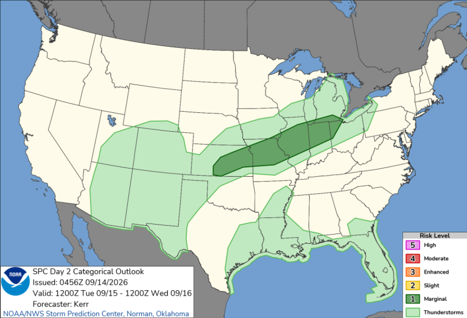
The Storm Prediction Center has placed parts of the Chicago area, stretching from the city to the south and southwest suburbs and in northwest Indiana, under a “marginal” or level one risk of severe weather. Heavy rain and gusty winds will be the biggest threat, with more than a half-inch of rain expected for some.
Temperatures and humidity Tuesday will also increase, jumping up to a high of 82 degrees. By Wednesday, they’ll drop into the low 70s following a cold front, with more chances for showers and storms through at least Thursday.
Nature Sep 12
‘High' bird migration alert continues as millions fly over Chicago area
Chicago Weather Aug 20
Farmer's Almanac, Super El Niño, NWS: Winter predictions for 2026-27 season
Chicago Weather Aug 10
Will Chicago see a cold, snowy winter? Here what the Farmer's Almanac predicts
This story uses functionality that may not work in our app. to open the story in your web browser.

 点赞
点赞 收藏
收藏 点踩
点踩 分享
分享