‘Tornado not out of the question:' Severe weather threat looms with hail, heavy downpours possible

The chance for strong or even severe storms with heavy downpours, large hail, wind gusts as high as 60 mph is back in the Chicago area forecast Friday.
“Storms on the way,” NBC 5 Storm Team Meteorologist Pete Sack said Friday morning. “Sounding like a broken record here.”
Friday starts out dry and sunny, Sack said, with a “beautiful start to the day.” By about 3 p.m., storms just over at the border near the Illinois-Wisconsin state line will develop, bringing the chance for an isolated storm or two in the Chicago area.
By about 6 p.m., showers and storms were expected to start filling in. More storms are expected about 8 p.m. starting to the north and west, and some could be severe.
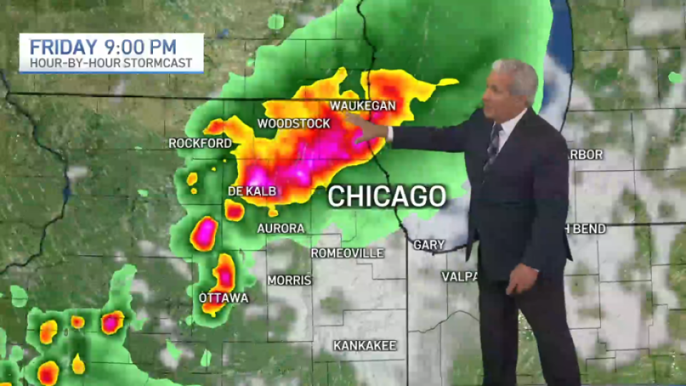
“If you hear thunder, get indoors,” Sack said.
Around 10 p.m., storms will push down into Chicago as well as areas near Aurora, Morris and Romeoville. By midnight, storms will slide into the far south suburbs and into northwest Indiana, Sack said.
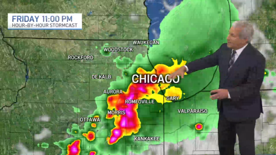
Severe weather risk: Level 2
From about 8 p.m. through midnight, the entire Chicago area will be at a “slight” risk of severe weather, which ranks as level two of five. Heavy downpours with localized flooding, half-dollar sized hail, damaging winds were all possible, Sack said, along with the chance for a tornado.
“An isolated tornado is not out of the question,” Sack said. “Unfortunately, we cannot rule out that possibility.”
According to the National Weather Service, the main tornado threat area lies west of the Fox River Valley.
(🧵1/2) Scattered thunderstorms are expected this afternoon and evening. A few storms may become severe with damaging winds and large hail the main threats. Be sure to have multiple ways to receive warnings! #ILwx #INwx pic.twitter.com/icLIIpdKtd— NWS Chicago (@NWSChicago) August 21, 2026
Saturday, an isolated thunderstorm or two could develop in the early evening.
Temperatures Friday will be in the 80s, with readings dropping into the 70s for the weekend.

 点赞
点赞 收藏
收藏 点踩
点踩 分享
分享